Other posts
Between November - June Transfagarasan road is closed on section between kilometer 104 (Piscu Negru - Arges county) and 130.8 kilometer (Balea Waterfall - Sibiu county) until 1 July 2016. From Balea Waterfall can be reached to Balea Lac only by cable car.
read more...
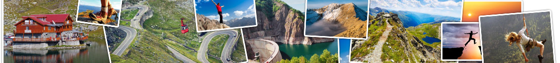
Crossing over a length of 151 km, from north to south, Fagaras Mountains, the highest mountain range in Romania, which is part of the Carpathians, DN7C called Transfagarasan is a spectacular highway which connects the historical region of Wallachia and Transylvania , built between 1970-1974.
read more...
In the list of the oldest medieval Romanian monuments enroll also cave churches in the monastic complex from șinca Veche, settlement located at 45 km from Brasov, 22 km from Fagaras and 3 km from the șinca village, known place thanks to historian and philologis Romanian Gheorghe șincai, family which has its roots here.
read more...