Other posts
We know today that the name Fagaras Mountains derives from Hungarian linguists although opinions are divided, on the one hand there is the word "fogor" - partridge, and on the other hand, more joke more seriously, is under discussion the expression "fa-garas', ie money from wood, which has its origin in the tradition of the eighteenth century when workers received their labor in exchange for some tickets, evidence of wood, which they then exchanged for cash.
read more...
Urlea Lake (4 m deep, occupying an area of 20150 sqm, at an altitude of 2170 m) it is found in the circus of Urlea and Pojorta Valleys between debris. At 2150 m, in the same valley, there is another lake, smaller, Urlea II that dries in dry years. Lake of Mogos (at an altitude of 2,150 m) it is found at S of the Peak of Mogos, besides touristic routes.
read more...
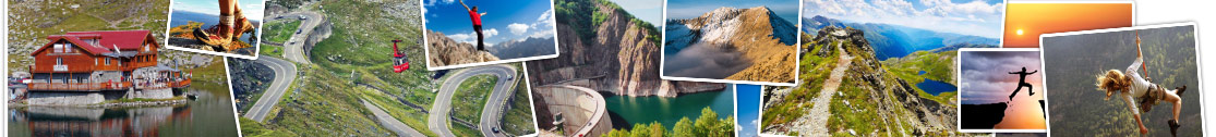
Along the Transfagarasan, at 40 kilometers from Curtea de Arges, between Pleasa and Vidraru slopes, is located Vidraru Lake and Dam - built between 1960 to 1966, for the production of electricity, irrigation and flood prevention, being now an excellent place also for recreation, tourism and sports, eg Bungee jumping extreme sport.
read more...